
regional economics
A new method for measuring vegetation: LiDAR data

Modernization of agricultural land use across Europe is responsible for a substantial decline of linear vegetation elements such as tree lines, hedgerows, riparian vegetation and green lanes. These linear objects have an important function for biodiversity, e.g. as ecological corridors and local habitats for many animal and plant species. Knowledge on their spatial distribution is…
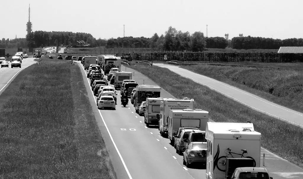
Read MoreManaging congestion with tradable permits: The best of both worlds?
The recent rapid growth in traffic congestion in The Netherlands has revived discussions on how to best deal with this persistent challenge for urban policy makers. It was already back in the 1920’s that the Cambridge economist Arthur Pigou developed what is to date the textbook analysis of the economics of traffic congestion; including a clear…
Read MoreThe billion pound drop: Did the Blitz enhance London’s economy?

The Blitz lasted from September 1940 to May 1941, during which the Luftwaffe dropped 18,291 tons of high explosives and countless incendiaries across Greater London. Although these attacks have now largely faded from living memory, our recent paper ”The Billion Pound Drop” shows that the impact of the Blitz remains evident to this day in…
Read MoreEmpty homes, longer commutes: Effects of more restrictive local planning

We have argued for a very long time that the fundamental problem with housing in Britain is a lack of supply: we have been underbuilding for two generations. Updating the simple estimate one of us made in 2014, the shortfall in building in England just since 1994 has gone up from about 2m homes to…
Read MoreEthnic restaurants do increase the attractiveness of cities

Living Apart Together: The economic value of ethnic diversity in cities Why are cosmopolitan cities like New York, London, and Amsterdam attractive residential locations? Apart from the fact that there are many well paid jobs, these attractive residential cities are also rich in amenities. These amenities include good public services, but also an abundant supply…
Read MoreIt is worthwhile to keep investing in historic buildings

In many countries, vast amounts of public money are invested to preserve historic buildings. In the Netherlands, for example, total public expenditures on renovation subsidies have been more than a billion euros since the 1970s. In Britain, more than 45 thousand buildings are listed, which implies that they are eligible for substantial subsidies, e.g. via…
Read MoreParking policy: The optimal occupancy rate in residential areas

Providing parking permits to residents (and companies) is standard procedure in Dutch parking policy. Issuing parking permits takes different forms: in many areas permits are no longer granted to every resident who wants one. The larger cities in particular impose restrictions on the number of cars per household: in some areas of Amsterdam residents can…
Read MoreHousing trends in the Netherlands: Urban densification continues

Urban areas are rapidly transforming. This is particularly true in the Netherlands where residential development is continuing to claim agricultural land alongside with transforming vacant industrial buildings or filling under-used sites. Future developments are the topic of heated debates and especially the potential of urban transformations to accommodate the projected growth in housing stock is…
Read MoreCrime and social interactions in Dutch neighbourhoods

Some neighbourhoods are breeding grounds of crime whereas in others the number of criminals can be counted on the fingers of one hand. Neighbourhood differences in crime cannot be completely explained by social and economic differences between neighbourhoods and residents. Social interactions may offer an additional explanation: people get more easily involved in criminal behaviour…
Read MoreInternational borders still limit local population growth in western EU
Decades of international economic integration in western Europe have not managed to stimulate population growth in border regions. In a recent article published in the Journal of Transport Geography, Chris Jacobs-Crisioni and Eric Koomen studied the relation between municipal population growth and transport accessibility over the past 50 years. Lack of cross-border transport supply has repeatedly been blamed for…
Read More